Progress at November 2016
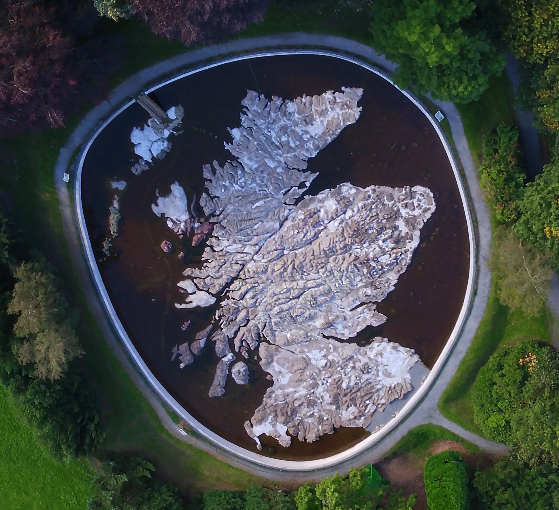
We have reached some major milestones after this summers work programme. All declared objectives to our grant providers, sponsors and supporters have been delivered:
1. Stabilisation and restoration of the map to better than the condition at which it was left in 1980.
2. Achievement of foundation reinforcement using over 50,000kg of frost resistant concrete and mortar.
3. Dissemination of the historical background to the map through fixed information panels, leaflets, talks, exposure on regional, national and global television.
4. Establishment of website, Facebook site and Wikipedia site.
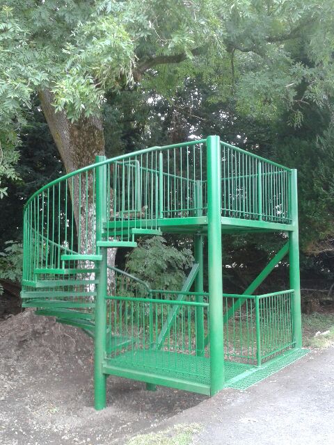
5. Design and construction of a new elevated viewing tower to view the map from a scale altitude of 48,000 metres.
It remains to complete crack sealing and improved detail to the topography. Longer term aspirations include painting and supply of water to the heads of the major glens. We are often asked “when will you finish it?” There is no simple answer because there is no clear end point when you could carry on adding detail for ever at finer and finer scale. The purpose of a map is to provide a simplified representation of reality for a a purpose defined by the user. Our visitors want more and more detail. The reality is that even to preserve what we have will need effort to offset the effects of weather and slow degradation. The Mapa Scotland volunteer force is very small, with an ominous age profile. This project now needs a new injection of constructive engagement by local community groups to look after this globally unique and valuable monument.